Category Archives: Boating, swimming and fishing
Info to help you find your way around our lakes
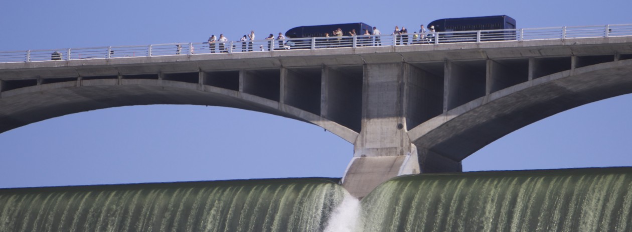
Popular fishing spot at base of dam reopens

You can now fish along the east side of the Columbia River near the Third Powerhouse of Grand Coulee Dam from sunrise until sunset.
Closed after the September 11 terrorist attack in 2001, the spot is being reopened nearly 17 years later and will be patrolled by Colville Tribal Enforcement, a Colville Confederated Tribes Fish & Wildlife press release stated Friday.
Boats are not allowed past the SR-155 bridge in Coulee Dam, but anglers on foot can walk on a trail above the riprap rocks all the way to a popular rock formation right near the Third Powerhouse.
“Fishermen must take the Lone Pine exit from Highway 155 to the Down River Trail Road and park in the designated parking area,” the tribal press release stated. “Non-tribal members must have a tribal fishing permit in order to fish in this location. Colville tribal members must possess a Colville tribal identification card, which is a legal permit to fish. If safety issues are observed, security will re-evaluate the boundaries for access. For safety reasons, we would like the public to be aware that water flows will pick up during the spring run-off season, so please be careful.”
For regulations and permits, interested persons should visit https://www.cct-fnw.com/regulations-permits.
For more information, contact the Resident Fisheries Manager, Bret Nine, at 509-209-2419 or the Fish and Wildlife office at 509-634-2110.

Where to camp in the Grand Coulee Dam area

Ah, the great outdoors. What better way to appreciate it than to go camping? Check out our page on camping in the Grand Coulee Dam area here.
Details on the wide variety of fishing in the Coulee area
Our page titled Are the fish biting? includes a lot of details on places to fish in the Grand Coulee area, what kinds of fish there are, a month by month guide, and more. Check it out!

How high is the water? What boat launches are available?

Boaters need to be aware that Lake Roosevelt, and access to it, changes dramatically throughout the year, depending on many factors, to which the Bureau of Reclamation, which operates Grand Coulee Dam, responds.
Below is a list of the minimum elevations above sea level at which you can launch a boat at launches controlled by the National Park Service.
Know before you go and check the current level of the lake. Read the column under “Forebay”. (The link is to a site maintained by the Army Corps of Engineers, which coordinates with the Bureau of Reclamation on operating the lake for flood control purposes.)
As you can see, the lowest level launch is Spring Canyon, just outside Grand Coulee, WA.
MINIMUM BOAT LAUNCH ELEVATIONS
Crescent Bay 1265′
Spring Canyon 1222′
Keller Ferry 1229′
Hansen Harbor 1253′
Jones Bay 1266′
Lincoln Mill 1245′
Hawk Creek 1281′
Seven Bays 1227′
Fort Spokane 1247′
Porcupine Bay 1243′
Hunters Camp 1230′
Gifford 1249′
Daisy 1265′
Bradbury Beach 1251′
Kettle Falls 1234′
Marcus Island 1281′
Evans 1280′
North Gorge 1280′
Snag Cove 1277′
French Rocks 1265′
Napoleon Bridge 1280′
China Bend 1277′