Laser Light Show starts nightly on May 28

laser show


Grand Coulee Dam Visitor Center Begins Laser Light Show May 28

GRAND COULEE, Washington – On May 28, Grand Coulee Dam Visitor Center will begin its extended summer season hours, along with its Laser Light Show which plays nightly through the end of September.

Visitor Center hours will be from 8:30 a.m. until one hour past the start of the Laser Light Show. Through the end of July, the show will begin at 10 p.m. For August, the show begins at 9:30 p.m. and for September, 8:30 p.m.

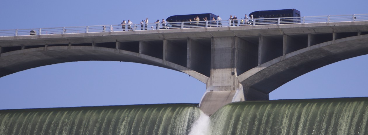
May 28 will also begin an increase in the number of public tours into the John W. Keys III Pump-Generating Plant. These one hour tours occur daily from 10 a.m. – 5 p.m. Visitors will ride a shuttle bus to the pumping plant to view gigantic pumps lifting water from Lake Roosevelt to Banks Lake, which then delivers water throughout the Columbia Basin Irrigation Project. The shuttle will then take visitors across the top of Grand Coulee Dam for spectacular views of Lake Roosevelt and the Columbia River.

Tours are on a first-come, first-served basis. No reservations are taken and space is limited.

For more information call the Grand Coulee Dam Visitor Center at (509) 633-9265. Or visit:  http://www.usbr.gov/pn/grandcoulee/visit/index.html

Northrup Canyon invites you

A spring hike up Northrup Canyon puts you in the midst of a thriving environment between coulee walls.

Soon, Northrup Canyon will be full of green. If you like a nice hike, this one is recommended.

It’s a great place to shake off winter and welcome spring. A creek runs through part of it, and a blue sky gives a beautiful contrast to the basalt coulee walls that rise up closely on either side.

Don’t forget to take water. It can be a three- to four-hour hike, or more, depending on how far you want to go.

An old homestead of the Northrup family sits at at nice turnaround spot at the top of the canyon. But you can go further, up a rough trail to a small hidden lake.

A restroom and information kiosk sits near gate at the beginning of the trail, but there no facilities past that. As a part of the state park system, a Discover Pass is required to visit. The most convenient place to get one is at Coulee Playland in Electric City.


The inside story today at the dam

Electrical switchyard
One of the switchyards used in directing the electricity produced at Grand Coulee Dam onto the grid that powers several states.

If you’d like to glimpse the inside story of one aspect of the mission of Grand Coulee Dam, this is a good video.

The dam was originally conceived to provide irrigation to more than a million acres of potential farmland in the Columbia basin, but these days most people think of it as a huge electricity producer.

It is that, but this video, produced by the Bureau of Reclamation as a tool to help potential recruits, also provides a good overview of the basics with some spectacular footage. Watching it will help you appreciate what you see when you visit in person.

Grand Coulee Dam is the largest electrical production facility of any kind, in terms of capacity, in North America. But it doesn’t just happen magically. These folks make it happen. Watch:

We’ve been discovered again.

We love it when you visit us!
And the view you’ve shown in your Instagram account, from the Crown Point Lookout, always inspires.

Thanks for stopping by.

InstagramCrownPoint

From Instragram: jenkrajicek    Detour to Grand Coulee Dam. This is what happens when I let Henry navigate


Wondering how Henry found this great viewpoint?

Below is a map. From the Visitor Center at Grand Coulee Dam, take a left to go uphill on highway 155. Continue to the intersection with highway 174 and turn right. Follow 174 until you see the sign directing you to Crown Point Overlook.

This is a state park site, and a Discover Pass is required, but the view of the dam and down river is spectacular.

MaptoCrownPoint

Take a tour on a bridge

Take a tour on a bridge.
Porcelain enamel signs on either side of the bridge across the Columbia River provide a history of the dam and the area’s geology. Parking is available on the streets on the west side of the river.

You can take a unique tour on the bridge across the Columbia River, simply by walking across it and reading several signs depicting history and geology.

The tour is self-guided and free.

It takes advantage of the four-foot-wide sidewalks along each side of the 950-foot span across the river to tell the story, on the upstream side of the bridge, of the building of the dam.

Cross over to the downstream side and you’ll find out just how the site was formed geologically. Its fascinating prehistory led to this being the perfect site to build the Grand Coulee Dam. (Hint: humans weren’t the first to make a dam here.)

Depending on how fast you read, walk and absorb the fantastic story, the tour could take from a half hour to an hour.

Or, if you just want a brisk walk in a unique location with an unobstructed view of the dam, this is a good one.

It’s an exciting walk for most people, and safe, but if you’re extremely queasy about heights, this could be a little too exciting.

The bridge itself rests on two monolithic piers that rest securely on bedrock, each 150 feet high. Approximately 300 tons of structural carbon and silicon steel makes up the cantilever truss bridge that the U.S. Bureau of Reclamation began to build in late 1934.

It was designed by the Washington Department of Highways for the Columbia Basin Commission to serve a dual purpose, according to documents on file with the Historic American Engineering Record. It would initially serve in the transport of heavy equipment during construction of the dam, then as a permanent highway bridge for State Route 155. That meant the bridge was built to a heavier specification than normally would have been used for a highway bridge.

But as construction of the bridge neared completion, the east pier tilted nine inches, probably because of a deposit of fine glacial material that lay beneath the 20 or 30 feet of gravel at the surface layer.

The incident delayed completion of the bridge for several months, while a 50-ton jack, cables and 72-foot deadman steel beams on the shore kept all in place until the foundation was secured through the construction of pneumatic caissons.